The strange giant figures on Google Maps: What are they, what are they for and how can you find them?
If you like exploring Google Maps, you’ve surely come across some surprises. There are many strange and unknown things that are hidden in the world, and that have been discovered thanks to satellite images.
Users have found all kinds of things over the years, like weird coordinates or even abandoned places.
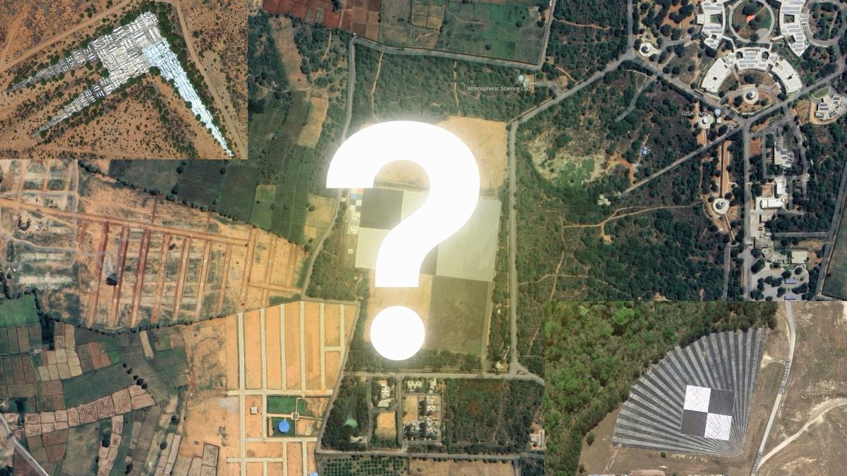
One of the videos that has begun to go viral on social networks, especially on TikTok, are the mysterious giant codesalso known as barcodes that are in various parts of the world.
These “objects” are large structures, usually made of concrete or asphalt, that are impressed into the ground. They are very difficult to see with the naked eye, since they are usually in remote places. The only way to see them is through Google Maps.
What are the giant figures on Google Maps?
In accordance with Map Nerd, these codes are actually calibration targetsalso called spatial eye charts or aerial surveillance objectives.
They are mainly used to calibrate satellite artificial vision systems.weather balloons, spy planes and other aircraft.
It should be noted that they have a series of geometric patterns that are used to measure the distance between the target and the aircraft, as well as its orientation.
This information allows precise images and videos to be taken from above, so its use is exclusive to governments.
This is how you can find the mysterious giant codes
Calibration targets are located in various locations around the world, but most are in remote locations or inside military bases. From Shadnagar in India to Edwards Air Force Base in California, United States.
If you want to check it out for yourself, you can easily access these codes. To do this, use the coordinates that we share with you after the jump:
- Shadnagar: Telangana, India.
- Fort Huachuca: Arizona, United States.
- Stennis Space Center: Mississippi, United States.
- Edwards AFB: California, United States.
- Eglin AFB: California, United States.
- Casa Grande Photogrammetric Test Range: Arizona, United States.
These huge patterns of black and white lines are more than just marks on the Earth’s surface. They are examples of how technology and cartography They are combined to create calibration targets.
With the help of the Google Maps app, you can explore these stunning giant barcodes from anywhere, which are nothing strange, they are simply objectives of aerial surveillance.